





Quick Summary
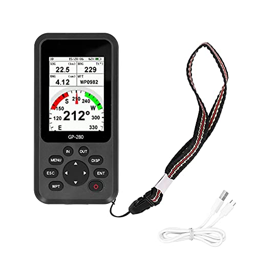
The HUVIOVED land surveying equipment handheld GPS navigation device is designed for outdoor navigation and surveying in places such as forest, farmland, mountain, mining and lake environments. It is described with a 3.2 inch semi transparent reflective colour screen, which is intended to help with readability in different lighting conditions.
Who It Is Best For
This device will suit buyers who need a handheld GPS for outdoor surveying, map use, or navigation across varied terrain. It may appeal to people who want a portable unit with built in map support, waypoint storage, and satellite system compatibility in one device.
What To Know Before You Buy
The product is listed with several practical features, but buyers should check that it matches their exact surveying or navigation needs before ordering.
Pros: It includes a colour screen, multiple satellite system support, internal memory, and a rechargeable battery.
Cons: The product name and description are broad, so buyers should confirm the exact variation and suitability for their intended use.
Common Buyer Questions
What is this device for?
It is a handheld GPS navigation and surveying device for outdoor use.
Can it be used in different outdoor settings?
It is described for use in places such as forest, farmland, mountain, mining and lake environments.
Does it have map support?
Yes, it comes preloaded with worldwide and USA base maps and supports map navigation.
What screen does it use?
It has a 3.2 inch semi transparent reflective colour screen.
What comes in the box?
It includes a USB cable, a suspension cord and a user manual.
Key Details
| Detail | What it means in use |
|---|---|
| Brand | HUVIOVED |
| Product type | Handheld GPS navigation device for land surveying |
| Screen | 3.2 inch semi transparent reflective colour screen |
| Battery | 4000mAh Li ion battery |
| Waterproof rating | IP67 |
| Satellite systems | GPS, BEIDOU, GLONASS and QZSS |
| Position accuracy | About 1 metre |
| Position time | 45 seconds |
| Coordinate system | WGS84 and UTM |
| Waypoint storage | Up to 10000 waypoints |
| Route storage | 1000 routes |
| Track storage | 1000 tracks |
| Maps | Worldwide and USA base maps |
| Memory | 16GB internal memory |
| Included accessories | USB cable, suspension cord and user manual |
Final Buying View
If you want a handheld GPS surveying device with map support, multiple satellite system compatibility and a practical outdoor focused design, this HUVIOVED unit gives you a clear set of features to compare. It is a straightforward choice for buyers who want a portable device for navigation and surveying and prefer the reassurance of built in memory, base maps and included accessories. Check the exact details before ordering so you know it suits your intended use.