


Quick Summary
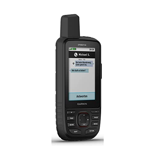
The Garmin GPSMAP 66i is a GPS handheld and satellite communicator made for outdoor navigation and communication. It combines TopoActive mapping with inReach technology, and it includes a large 3 inch sunlight readable colour display for easier viewing in the field.
Who It Is Best For
This is suited to walkers, hikers, explorers and anyone who wants a handheld device for navigation plus satellite messaging in one unit. It will also appeal to people who want mapping, route management and weather access while away from mobile coverage.
What To Know Before You Buy
The device is listed with a satellite subscription requirement for two way messaging and SOS monitoring. It also has cellular connectivity for active weather forecasts and geocaching live. A notice states that some jurisdictions regulate or prohibit the use of satellite communications devices, so it is worth checking local rules before ordering.
Pros: Combines handheld GPS and satellite communication, with mapping and trip management features in one device.
Cons: Satellite messaging requires a subscription, and legal use may depend on your location.
Common Buyer Questions
What does the Garmin GPSMAP 66i do?
It is a GPS handheld and satellite communicator that supports navigation, messaging and outdoor trip planning.
Does it include mapping?
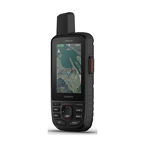
Yes. It includes TopoActive mapping and direct to device Birdseye satellite imagery downloads.
Can I send messages with it?
Yes. It supports two way messaging through the Iridium satellite network, with a satellite subscription required.
Is it useful away from mobile signal?
Yes. It is designed for outdoor use where handheld navigation and satellite communication are helpful.
Should I check anything before buying?
Yes. Check satellite service requirements and local rules for satellite communications devices before ordering.
Key Details
| Detail | What it means in use |
|---|---|
| Product type | GPS handheld and satellite communicator |
| Brand | Garmin |
| Model | GPSMAP 66i |
| Display | Large 3 inch sunlight readable colour display |
| Mapping | Preloaded Garmin TOPO mapping with Birdseye satellite imagery downloads |
| Satellite messaging | Two way messaging via the Iridium satellite network, with subscription required |
| SOS feature | Interactive SOS to a search and rescue monitoring centre |
| Navigation support | Multiple global navigation satellite systems support and navigation sensors |
| Weather and live features | Cellular connectivity for active weather forecasts and geocaching live |
| App and website compatibility | Compatible with the Garmin explore website and app |
| Battery life | Up to 35 hours in 10 minute tracking mode and 200 hours in Expedition mode |
Final Buying View
The Garmin GPSMAP 66i brings handheld GPS navigation and satellite communication together in one outdoor ready device. If you want mapping, messaging, SOS support and trip management in a single unit, it is a practical option to consider. Check the subscription requirement and local regulations before you buy.