




Quick Summary
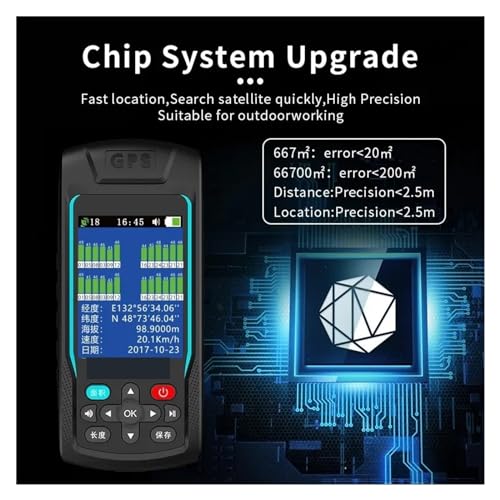
The MC8066C is a handheld GPS for surveying and land area measuring, designed for outdoor use and for checking terrain with draw track map support. It is described as having fast location, quick satellite search, high precision, 99 groups of data storage, and English or Chinese interface language options.
Who It Is Best For
This is a practical choice for people who want a compact handheld measuring device for outdoor land checks, terrain measurement, or general surveying tasks. It also suits users who want a simple portable unit that can be held in one hand and used in more than one measuring mode.
What To Know Before You Buy
The device is listed with English and Chinese language options, so it may suit users who are comfortable working in either language. It is also described as suitable for both handheld measurement and autocar measurement.
Pros: Compact, portable, and described as easy to hold with one hand, with data storage and two language options.
Cons: Check the selected variation and suitability carefully if you need a specific surveying setup or workflow.
Common Buyer Questions
What is the MC8066C used for?
It is described as a handheld GPS for surveying, land area measurement, and terrain measurement.
Does it store data?
Yes, it is listed with 99 groups of data storage.
Is it easy to carry?
It is described as compact, portable, and easy to hold in one hand.
What languages does it support?
It is listed with English and Chinese interface language options.
Can it be used in different ways?
It is described as supporting both handheld measurement and autocar measurement.
Key Details
| Detail | What it means in use |
|---|---|
| Model MC8066C | Identifies the specific unit listed for this product. |
| Handheld GPS for surveying | Indicates the product is intended for land and terrain measuring tasks. |
| Draw track map | Shows the unit is described as supporting track mapping use. |
| 99 groups of data storage | Allows stored measurement data to be kept for later inquiry. |
| English and Chinese interface language | Gives two language options for the user interface. |
| Compact and portable | Suggests it is easy to carry and hold by hand. |
| Handheld measurement and autocar measurement | Indicates two stated ways of using the device. |
Final Buying View
The MC8066C is a compact handheld GPS measuring device for surveying, land area measurement, and terrain checks. With data storage, two language options, and support for both handheld and autocar measurement, it offers a straightforward set of features for practical outdoor use. If that matches what you need, it is worth checking the selected variation before ordering.


