


Quick Summary
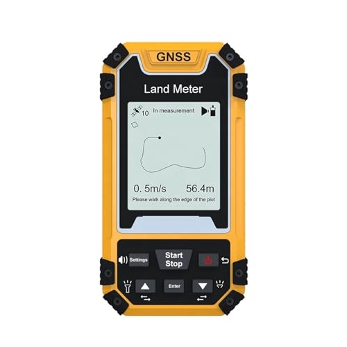
The Handheld GPS for Surveying S1 GPS Land Meter is a GPS land surveying tool for area and length measurement on farmland and irregular terrain. It is described as using a high sensitivity GNSS receiver chip, with automatic farmland area and length measurement, and it can export data after use.
Who It Is Best For
This is suited to buyers who need a handheld tool for land area checking, length measurement, and simple field recording. It may appeal to anyone who wants a practical surveying aid with straightforward operation and data export, especially where automatic measurement is useful.
What To Know Before You Buy
The product is described with a range of measurement and protection features, but the exact setup, capacity, and detailed operating limits are not provided. If you need a specific measurement workflow or unit setup, check the selected variation and any included instructions before ordering.
Pros: It combines area and length measurement with data export and is described as easy to operate.
Cons: Detailed specifications are limited, so suitability for a particular surveying task should be checked carefully.
Common Buyer Questions
What does this GPS land meter do?
It is designed for land area and length measurement, including use on farmland and irregular terrain.
Can it export data?
Yes, it is described as able to export data after measurement.
Is it easy to use?
It is described as easy to operate, which may suit buyers who want a simple handheld tool.
Does it show working price information?
It is described as able to display unit price and total working price after measurement.
Does it have protection against weather and dust?
It is described as fallproof, waterproof and dustproof.
Key Details
| Detail | What it means in use |
|---|---|
| Handheld GPS surveying tool | Designed for portable land measurement work |
| S1 GPS Land Meter | Product name used to identify the model |
| High sensitivity GNSS receiver chip | Built with a receiver chip described for signal reception |
| Automatic farmland area and length measurement | Helps measure land area and length directly |
| Easy to operate | Intended for straightforward use in the field |
| Able to export data | Allows measurement data to be taken off the device |
| Unit price and total working price display after measurement | Shows pricing information after use |
| Fallproof, waterproof and dustproof | Described as suitable for tougher field conditions |
Final Buying View
This handheld GPS surveying meter brings together land area and length measurement, data export, and a straightforward operating style in one field tool. It is a sensible choice if you want a practical way to measure farmland or irregular terrain and value the added pricing display feature. If that matches your needs, it is worth checking the chosen variation before ordering.


